Saturday, December 15, 2012

Night Crossing - Florida to the Bahamas

12 Dec 2012  2348 - 13 Dec 2012 0736  Key Biscayne, FL to South Bimini, Bahamas  (50nm/57.5sm)

I'm not too keen on night crossings.  But after evaluating the weather, a good window was open tonight to go.  After that we might wait for several days for another one to open.  We didn't leave alone.  Two catamarans in the anchorage headed out right before us.  We were headed out the Cape Florida Channel into the Atlantic Ocean.  There are lit and unlit navigation aids.  The blue areas on the charts are shallow.  Imagine driving your car without any headlights or street lights on an unknown road.

Cape Florida Channel
So, using our GPS, radar overlaid on the chartplotter and our bright spotlight, we slowly navigated out to sea.  The bright lights of Miami provided back illumination for miles.  Ahead of us, it was pitch dark.  The radar showed us where ships and other boats were located relative to our position and the AIS (Automated Identification System) gave us the names of vessels with a transmitting AIS.  The big ships have AIS.  Before we could ever see the Royal Caribbean LIBERTY OF THE SEAS, she was just a glow in the distance.  She passed 5 miles off our bow and must have had every light on. 

Royal Caribbean Liberty of the Seas

 On my watch, a merchant ship came within 2 miles of our position before she also changed course.  Ted hailed her, and as we were the privileged vessel with the "right of way", the merchant ship changed course and passed behind us.  I find staring into the inky darkness a little spooky; but the radar gives me a picture of what's out there.  Our heading was 120 degrees; our course made good was about 092 degrees.  Why?  We have to account for the impact the Gulf Stream will have on our course.  We were literally crabbing across the Gulf Stream most of the night.

At twilight you could begin to see North Bimini take shape. 

North Bimini at twilight
And right before our eyes two whales passed in front of us, we slowed down to catch a possible picture but to no avail.  We arrived at the Bimini Sands marina at 7:36AM.  Here's a view from the marina looking out the channel.  That ship is headed into North Bimini.

Channel - Bimini Sands marina
Checking in with Customs and Immigration is the next order of business.  Ted takes the paperwork and catches a ride to the airport to complete the process.  We headed over to North Bimini by water taxi, $2.00 ea each way, to conduct business with the local Bahamas Telecommunications office.

North Bimini from the water taxi

The University of Miami sponsors the Bimini Biological Field Station here on South Bimini.  They conduct shark research.  We were able to join the last tour of the year while we were here this time. 

BBFS - Shark pen photo from their Facebook page


After a presentation and tour of the lab facility we walked out to the shark pens at low tide - ankle depth water.  Our French tour guide, Jean-Sebastien Finger (one of the Principal Investigators), carefully captured one of three juvenile lemon sharks in the pen. 

Lemon shark - BBFS
We may leave tomorrow and head across the Great Bahama Bank and anchor near Northwest Shoal.  The next day we plan to head into West Bay to anchor on the east end of New Providence island.  The 3rd day we will head into the Exumas.  I do not expect to have internet access until we reach Warderick Wells.


Sunday, May 13, 2012

24 April - 8 May 2012 Little Farmers Cay (Exumas) to Ft Lauderdale, FL

24 April 2012  1116-1323  Little Farmers Cay to Rudder Cut Cay, Exumas  11nm (xx sm)

We took advantage of the lull in the wind to continue cruising south on the Bank.  We passed David Copperfield's private island, Musha Cay and the surrounding 5 cays that he also owns.  The island is available to rent - BIG BUCKS!  The area south of Musha Cay requires Visual Piloting...i.e. you eyeball the water/bottom to decide if there is enough water for you to pass.  We proceeded down toward Rudder Cut Cay and anchored near a cave off the Cay.


View Larger Map 25 April 2012  0734-1130  Rudder Cay to Emerald Bay Marina, Exumas   23nm (xx sm)

Dan & Lucie Morley (S/V Trinity 1) had recommended that we check out the cave nearby.  We dinghied into the cave...take a look.
Ted on the beach in the cave
The cave from a distance
Beach on Rudder Cut Cay
The beach where the sign was posted

4 May 2012  1050-1701  Rudder Cut Cay to Emerald Bay Marina, Exumas  24 nm (27.5 sm)

With weather coming in again toward the weekend we opted for a safe dock in lieu of any more excitement.  Emerald Bay marina comes highly recommended by all cruisers.  The washers/dryers are free, as is the WIFI and cable TV; the showers come with shampoo, creme rinse, shaving cream and body soap - just bring your towel!  The boaters lounge is amazing...pool table, big screen TV, kitchen, etc. - you get the picture.  What is not to like?  They even have a NO SERVICE dock for those with solar power (no cable TV there).  Water is $0.40/gallon.  We did some exploring during our 9 day stay that included renting a car and exploring Great Exuma and Little Exuma Islands.

Entrance to Emerald Bay marina
The entrance can be a bit dicey in a strong NE wind; breaking waves make the entrance intimidating. 

We rode our bikes out up to the local Bahamas Telecommunication Office about 4 miles away only to learn that the office had closed several weeks ago.  The nearest BTC office is in George Town about 12 miles away.  We met a local independent politician and a British ex-pat along the way.  Stopped in the local grocery store and bought a couple items.  The best buy was Kerrygold butter for $1.98.  American imports are quite high; British food items are much more reasonable.

Nearby the marina property (which is part of the Sandals Resort) is Grand Isle Resort & Spa - an upscale neighborhood with private condos, homes and a golf course.

Golf course


Painted conch shells mark the area where one tees off at the golf course.

Sandals Resort
Entrance to Sandals Resort requires a day pass @ about $130.00.  Use of the pool at Grand Isle resort is now $30/day.  We passed but we did try out Grand Isle's Palappa restaurant.  Very good!

We played Mexican Train in the lounge several nights with this crowd of sailors.  It was a lot of fun. 

Judy, Ted, Julia, Greg, Cindy, Lyle and John
We rented a van with most of this crowd and explored Great Exhuma  north and south of Emerald Bay.

Beautiful beach - Barraterre (N of NW tip of Great Exuma Island)
Barraterre - Conch shells in the front yard
Barraterre - Beach combing (Cindy, Nancy)
Pompey (foreground) - Jail (background) in Rolle Town
Pompey was a slave who led a rebellion when 77 slaves were told they would be resettled on Cat Island.  He may well be considered a national hero for his role in the mini-rebellion against slavery.


How about this view?  We had lunch at Peace & Plenty.  This is the view of Elizabeth Harbor, George Town, from the pool deck.

Monument Beach anchorage - George Town, Great Exuma Island
Monument Beach is one of several popular anchorages in George Town.  Upwards of 400 cruisers can be found in George Town January through April.

Salt Marker - Williams Town
This marker guided ships in to pick up salt harvested from Little Exuma’s three salt ponds. The walls dividing the Great Salina into pans can still be seen. Designed as a Tuscan Column, the marker was most likely constructed in the Loyalist Era of the late 18th or early 19th century.

Santanas - Williams Town watering hole
Kailik - a local beer (even though its not brewed in the Bahamas anymore)

Ted, Greg & Judy (S/V My Destiny), John & Cindy (S/V Hawk)
Bread Store
Next to Santanas was Mom's.  We all bought bread; I bought coconut and raisin.

Mom's Bread
We spent an afternoon beach combing and came up empty.  The most interesting things we saw were this bird near the golf course and Dexter, an english staffordshire bull terrier on S/V Cypraea.

Bird on golf course
Anyone know what kind of bird this is?

Dexter
Similar bird in the pool at Grand Isle Resort

View Larger Map


4 May 2012  0737-1159  Emerald Bay Marina to Black Pt Settlement, Exumas  42 nm (48 sm)

Not sure why, but I took no pictures on the way up to Black Pt.  This was just an overnight anchorage for us as we'd stopped here when we were southbound.  We definitely have a stabilizer problem.  The port stabilizer makes the boat "shudder". 

5 May 2012  0737-1159  Black Pt Settlement to Emerald Rock, Warderick Wells, Exumas  26 nm  (29.8 sm)

We really enjoyed the Exumas Land & Sea Park, so back we went!  We could also get email here for $10.00 for 24 hours.  Important since we are trying to raise the stabilizer folks in Ft Lauderdale to see if there is any trouble shooting Ted can do.

As this is a Saturday night, the Park hosts a Happy Hour (they provide ice).  We reconnected with John & Cindy on S/V Hawk.  Cindy had invited us to join them for homemade conch chowder after Happy Hour (which was yummy!).

6 May 2012  1013-1500  Emerald Rock to Highbourne Cay, Exumas  30 nm (34.4  sm)

Another overnight anchorage.  At this point what was a minor stabilizer problem had become more aggravated.  We dinghied into the marina and bought more minutes for the BTC cellphone to call Ft Lauderdale.  It is about $0.75/minute.  The bar was closed because the staff had already gone to Nassau to vote in the elections on 7 May.  Beautiful day on the water.

Along the way to Highbourne Cay...can you believe this water?

Sunset at Highbourne Cay

Megayacht anchored behind us at Highbourne Cay


View Larger Map

7 May 2012  0746-2041  Highbourne Cay to Northwest Shoal, Grand Bahamas Bank  90nm (103.4 sm)

The weather was so nice we pressed on to save a day and to be sure we had good weather!

Sunset from the Tongue of the Ocean
Exiting the Tongue of the Ocean - Chart plotter view
In places, the Tongue of the Ocean is 6000' deep.  It narrows, like the tip of a tongue, as one enters the Grand Bahama Bank at Northwest Channel. You can see the boat icon on the chart plotter with the dotted line in front of the boat showing our heading.


View Larger Map

We exited the Tongue of the Ocean via the Northwest Channel and anchored on the Grand Bahama Bank.  Had a little trouble setting the anchor on the first try.  On the second try, I backed the engines up to 1600 rpm; it appeared we were set.  We set an anchor alarm with the chartplotter and watched it for about an hour.  Things looked good so we turned off the chartplotter and set an anchor alarm on the handheld GPS.  After a very long day we hit the sack thinking we'd stop at Bimini the next day.
 
8 May 2012  0240-1816  Northwest Shoal to Ft Lauderdale, FL  117nm (134.4 sm)

0130 - I wake up to the sound of the anchor alarm.  I look around, turn on the chart plotter and sure enough, we had dragged 42' outside of the 200' zone we'd set.  Ted had slept through the alarm.   We assumed that it happened when the tide changed directions.  Nonetheless as Ted went back to bed and I continued to watch the chart plotter, we continued to slowwwwly drag.  After 30 minutes I notified Ted.  I suggested we just get underway.  We had a full moon and nice weather.  It was about 57 miles to the Bank where we cross the Gulf Stream (another 50-ish miles) to Ft Lauderdale.

Sunrise on the Bank

The weather forecast was for SSW winds, 15-20 knots, 3-5' seas with an 8 second interval.  We have one working stabilizer which was certainly better than none!   I was most concerned about the sea state but it turned out to be a nice ride across the Gulf Stream.  10 miles outside Ft Lauderdale we could see 3 distinct thunderstorms converging on the area.  As we entered the inlet at Port Everglades, the rain eased. 

Rainy Ft Lauderdale - Approaching the 17th St Bridge

 Naturally,  by the time we were up the New River ready to tie up, it started pouring!  In spite of my rain gear, my shorts were soaked from mid thigh down.  Once we were tied up I hit the shower and ordered pizza (to be delivered) from Doughboys.

P.S.  The potentiometer for the stabilizer was replaced (ka-ching!).  As we got ready to get underway, the starter for the port engine bit the dust (ka-ching!!).

Here are a couple evening shots from Ft Lauderdale.

Highrise condo across from us

The Sheriff's Jail right next to us

Riverwalk across from us

Riverwalk behind the boat

Friday, April 27, 2012

10-24 April 2012 Warderick Wells to Little Farmers Cay, Exuma, Bahamas


10 April 2012  1018-1325  Warderick Wells to Cambridge Cay  16nm (18.4sm)

We headed out into Exuma Sound initially but there was a little more wind than predicted and we were pitching mildly.  The dinghy was trailing behind us and bouncing around more than we liked.  I was getting ready to remove the wine glasses from the upside down rack as they were starting to hit each other when the Captain decided to turn around.  Yea!  It turned out to be a wise decision as the cut we planned to enter had opposing wind and current by the time we passed by it.  For those of you who have ridden into New Jersey’s inlets in other than optimal conditions, this would have been a similar ride.

Navigating around Bells Island
In the photo above we kept the rock to our starboard side as we came around the western side of Bells Cay.  You can see where the narrow channel close along the west (left) side of the cay narrows and feeds into the channel heading north east.  That is where this rock was.
Once we were secured for the day, I noticed a turtle close by the boat.  He kept popping up and taking a look at us.  It took me several tries but I got a couple reasonable shots of him.

Turtle in Cambridge Cay

Sea turtle in Cambridge Cay

Just in case you are curious about what we are attached to on this mooring, I got a nice shot of the new concrete block and the original steel mooring ball which is lying on the bottom.


Snorkeling around Cambridge Cay
Having not snorkeled since we left Hawaii I finally got into the water to check out the snorkeling around Emerald Rock (Warderick Wells). The park provides a map of all the snorkeling areas and suggests the optimal time to snorkel these areas.  Emerald Rock had lots of pretty fish but it is a relatively small area.  I’m looking for the Exuma’s answer to Haunauma Bay (Hawaii)! 

At O’Brien’s Cay there’s a snorkeling area called The Sea Aquarium.  This was pretty cool.  With mooring buoys to tie your dinghy onto, there’s no swimming to get there.  What a beautiful spot!  There must have been at least 20 different varieties of fish and the live coral and fans (which I don’t think I’ve ever seen firsthand) is very pretty.  The fans come in a variety of colors – purple was certainly the prettiest!

We also did a “drift snorkel” at the south end of O’Brien’s Cay.  Hanging onto a line attached to the dinghy we let the current carry us through the area. It was nowhere near as spectacular as The Sea Aquarium.

Rocky Dundas – Caves
I wasn’t too keen about snorkeling into a cave but I could see light inside.  The cave has stalactites and stalagmites.   I was expecting Luray Caverns.  I was a wee bit disappointed.  But I must say I have never snorkeled into a cave and seen these formations.

Ted outside Cave 1 at Rocky Dundas

It is easiest to do this at low tide.  The opening is that dark area above the water. Here's a youTube video I found online that shows the inside of the cave and the opening.

There was a second cave but I was reluctant to go in there also until I could see Ted standing up.  There was light in there as well.

In addition to the caves, the variety of live coral was amazing.  There was a stand of elkhorn coral that had “petals” a good 2’ wide and the whole stand had to be 8’ across.  The coral was a gorgeous shade of yellow.  There were lots of coral and fish to see.  All I needed was frozen peas! 

Elkhorn Stand near Honeymoon Beach
We took the dinghy over to another area to check out a stand of elkhorn coral.  Amazing!  Next time we will have an underwater camera.


Hiking around Cambridge Cay
There are 2 trails on either end of the island. We did both. Some of the sights….

Bell Rock

Cambridge Cay mooring field - Aloha Friday in foreground

The end of the hike

Honeymoon Trail
We walked through a dense palm tree forest to get to Honeymoon Beach.

Nancy on the Honeymoon Trail

Surf at Honeymoon Beach
The surf had been flat here the day before and we snorkeled out on the left side where the rare stand of Elkhorn coral is.

16 April 2012  0920-1158  Cambridge Cay to Big Majors Spot, Staniel Cay  14nm (16sm)

A lot of these islands are privately owned.  There are few, if any, homes or inhabitants.  When you walk around, it is rare to pass anyone other than another cruiser.  No houses, no bars, restaurants or stores.  No TV.

South Bimini was populated – it was a small town.  Staniel Cay is populated – another small town of 80 odd residents.  
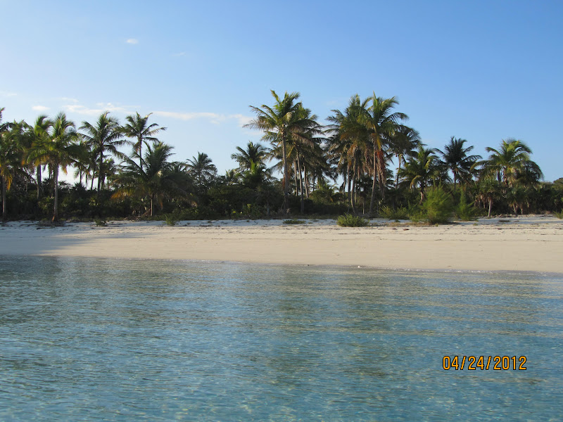
We bypassed Nassau on the way down so in between we saw one beautiful beach after another and water in varying shades of blue.
 
Staniel Cay

We dinghied into the marina to check out the Yacht Club and surrounding town. 

Staniel Cay Yacht Club

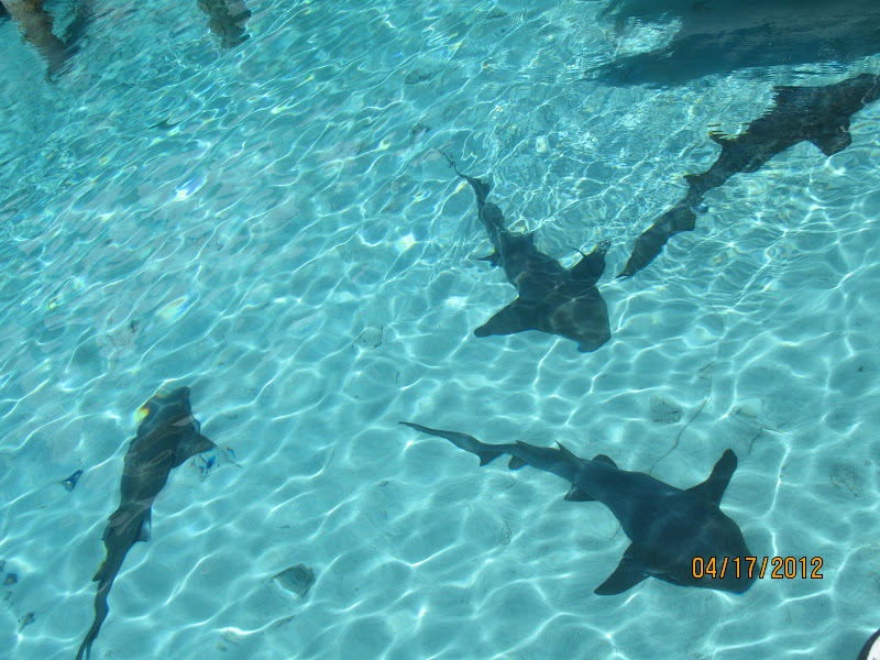
I was surprised to see the presence of about a dozen nurse sharks who call the marina home.

Nurse sharks - SCYC marina

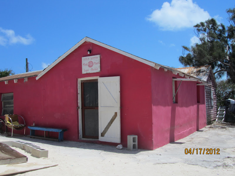
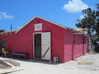
We set out to explore a bit and check out the grocery stores.  We stopped at The Pink Pearl Store, the Blue Store and dinghied over to Isles Grocery Store. 

If you grew up in a rural area, you might remember a small Mom & Pop grocery close to home.  Think smaller….  In the Blue Store I found some Kraft Sharp Cheese and Swiss cheese – total $12.00.  In the Pink Store I found nothing.  Isles Grocery was the best supplied of the three.  I found ½ gal of organic milk, a qt of half n’ half, a can of whipping cream and eggs for $22.40.  I struck out looking for Doritos, sour cream, sliced cheese and chocolate pudding. 

The Pink Store
The Blue Store
Isle Grocery
 Only the downstairs is the store.

We passed one of the Bahamian "fishing boats" that competes in the National Family Island Regatta the last week in April.   This event was started in 1954 to keep the traditional Bahamian fleet of fishing vessels alive. The boats have evolved to pure race boats over the years. and  The rules call for a wooden hull, deck and spars with canvas sails. No winches or instruments are allowed, not even tell tales for wind.  As mast heights and sail area have increased, pry boards are used to move human ballast out over the windward rail for stability. This is quite a spectacle, especially in gusty wind.  We were told by Reg Smith, an independent candidate for office, that the boats are really over-rigged.  If they take on a lot of water, they will sink!

"TIDA WAVE"
Later that evening we joined a group of 16 folks, largely Defever owners, for dinner at the SCYC.  Nice evening, good food.

The next day we snorkeled Thunderball Cave – made famous in the James Bond movie, Thunderball.  There were lots of fish, corals and fans to see.  Spotted some beautiful blue coral.  I am amazed at the variety of beautiful fish that we see. 

There are swimming pigs off the southernmost beach near our anchorage.   When they see you coming, the pigs swim out to your boat.  Ted fed them cut up sweet potatoes.  They would use their noses to butt the side of the boat, snorting off and on. 
Swimming pigs
Ted feeding the pigs
The pigs will butt the dinghy with their snout

18 April 2012  1357-1534  Big Majors Spot to Black Point Settlement  8nm (9.2 sm)

Once we were anchored, the crew of Miss Grace (Defever 44+5) invited us to join them to dinghy ashore to check out the town.  We stopped at Lorraine’s Café to order her famous coconut bread.   Mr Willie Rolle gave us a tour of the Garden of Eden he has created in his yard.  Willie has a vivid imagination.  He has used driftwood to create animals, fish and the profiles of famous people.  As barren as his land is, he is also growing papayas, avocados, tomatoes, lemongrass, peas, etc.  On our way back to the dinghy dock I also discovered the location of the laundromat. 

The laundromat is a real oasis here.  Ida, the proprietor , has 12 washers and almost as many dryers in a very nice facility.  They even had hot water the day I did laundry!  Sometimes it is the little things that make one happy.  Dinner aboard Miss Grace capped the day off.

Sunset from Black Point Settlement
I haven’t seen the green flash since we left Hawaii.  This sunset produced a green flash no one could miss.

Mail boat heading into Black Point settlement
The mail boat brings everything from mail to new vehicles, construction materials, and supplies for the grocery stores.  Everything comes on the mail boat!


View Larger Map


19 April 2012  0929-1216  Black Point Settlement to Little Farmers Cay   14nm (16 sm)

As we are expecting some westerly winds we continued to head south and sought cover on the south eastern side of Little Farmer's Cay at White Land Beach.


View Larger Map

Two of the sailboats we met on Shroud Cay were anchored here also.  We reconnected with them over dinner at Ocean Cabin and also met the owners, Ernestine & Terry Bain.  Ernestine treated us to  local favorite for dessert – Guava Duff.  It was similar to a jelly roll in appearance but was served warm with a nice sauce. 

We initially picked up a mooring ball at White Land Beach.   Not knowing the integrity of the mooring it was suggested that we put an anchor out also.   We decided to take another mooring that the folks at Ocean Cabin owned, believing it was suitable.  We moved over to the beach on the east side of Great Guana Cay.  We picked up the mooring ball behind the sailboat in the photo below. 


View Larger Map

This is where the trouble spot turned out to be.  Read on....
S/V Blue Water
The entrance to this "spit" of a mooring field is shallow so we had Jim on S/V Solitaire lead us into the mooring field.

On the 21st, Terry Bain suggested we put out an anchor in anticipation of the strong winds that were predicted.  Ted deployed our Fortress on the sandbar east of the mooring field.  We tended the rode each time the tide changed directions to either pull in slack line or deploy additional line as needed.  The weather came in as predicted.  On the morning of the 22nd at about 0840, Ted noticed that the line for the Fortress anchor was jammed on the stern bit and that the line had a heavy strain on it.  The engines were started to allow me to relieve the strain on the Fortress.  At the same time Ted observed that there was no strain on the mooring.  The chain connecting the pennant to the mooring had failed.  Ted pulled up the float, line and chain that had detached from the mooring and was attached to the bridle for the mooring ball.

Chain attaching the mooring to the weight.  The link at the top failed. 

The rain is coming down in buckets. The wind is pushing us onto the shallow sandbar and the current wants to take us toward the sailboat.  Nancy got the anchor line off the stern bit and with the extra line running to the bow roller allowed the fast moving current to quickly take us the 50 ft. down alongside Blue Water.  While maneuvering to get sea room between us, we caught S/V Blue Water’s mooring rode, pulling her toward us.  The minor collision knocked her starboard navigation light cover off and caused some minor damage to the stainless steel for their anchor roller.  We got a bent stanchion and minor fiberglass abrasions (which was not noticed until we were moored again)  Ted got into the water with just a face mask.  The mooring rode was caught forward on the port screw, thank goodness the line was not wrapped around the shaft.  Once it was released from the screw, it caught on the rudder.  On deck, I’m using 2 fenders to prevent any further damage from occurring between both boats.  S/V Blue Water powers astern to relieve the strain on the mooring rode.  Ted is able to release the rode from rudder.  Good thing we had a Navy diver aboard!  It took 30 min to get free. We’re not done yet….  Once Ted is back aboard, I shorten the scope of the rode on the Fortress to gain sea space from S/V Blue Water.   We spent the next hour in heavy rain, squalls and 50 kt winds. Ted is on the bridge.   I am on the bow shortening the scope as needed.  Engine power is applied to counter the wind that wants to put us on the shallow bank.  New friends on S/V Trinity 1 hailed us and made us aware of a heavy mooring that is used by the fuel boat at the Farmer's Cay Yacht Club.  There really was no choice but to move and a heavy mooring sounded good.  S/V Scherzo volunteered to assist us getting onto the mooring ball.  It was still raining and blowing.  Ted coils up the extra rode for the bow anchor that is still deployed and attaches a float to it.  I deploy the line and float over the side, untying the rest of the line that is through the bull nose on the bit.  We are free!  We head over to the Yacht Club mooring field and S/V Scherzo assists us from their dinghy.  Whew!  After two (2) hours of stress we are finally secure again!  We later learned that a sailboat in the White Land Beach mooring field also had their mooring give way.  Here's where we are moored now.


This storm became the nor’easter that those of you on the East Coast were hit with on the 23rd of April.  By 1pm, the sun was out and the wind and seas had fallen off.  What a transformation!

Farmer's Cay Yacht Club

Ty's Sunset Bar & Grill - Farmer's Cay airport

Conch shells
The conch shells above are in a large pile almost forming a breakwater.  Conch is very popular in the Bahamas among locals and visitors alike.

Sea Thimbles
These are small jellyfish that were passing by the boat in swarms.  They are about 1 1/2 inches in size.  They have a moderate sting.  Ted collected some in a net for a closer look.  They are sitting in a plastic cup in this photo.

Our last day here we joined some other cruisers for a walk around the island.  We ended up at Ali’s Tiki Bar (a liquor store) for a beer.  Ali was quite a character.

(l-r)  Jill (S/V Eärendil*, Dan & Lucie (S/V Trinity 1), Glenn Patch, Ali, Susie Patch (M/Y Magnolia)
The mermaid on the inside of the Tiki Bar door

Nancy & Lucie in front of the store

* Eärendil the Mariner (pronounced [ɛaˈrɛndil]) is a fictional character in J. R. R. Tolkien's Middle-earth legendarium. He is depicted in The Silmarillion as a great seafarer who, on his brow, carried the morning star across the sky.